
 Image 1 of 5
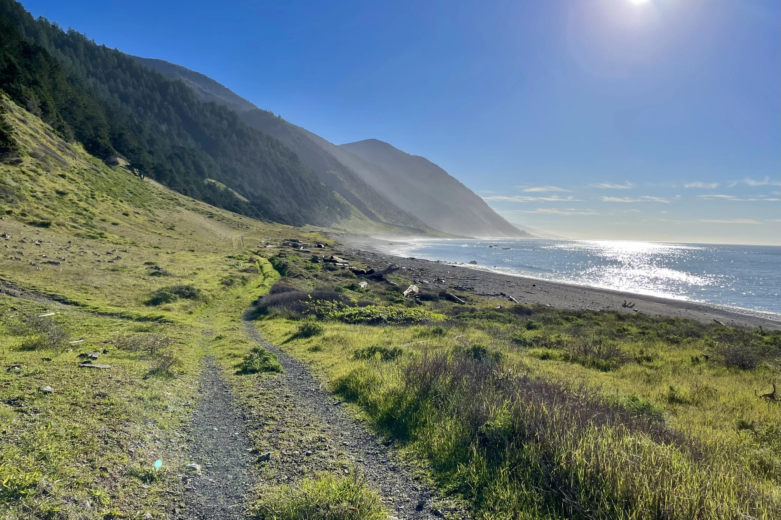 Image 2 of 5
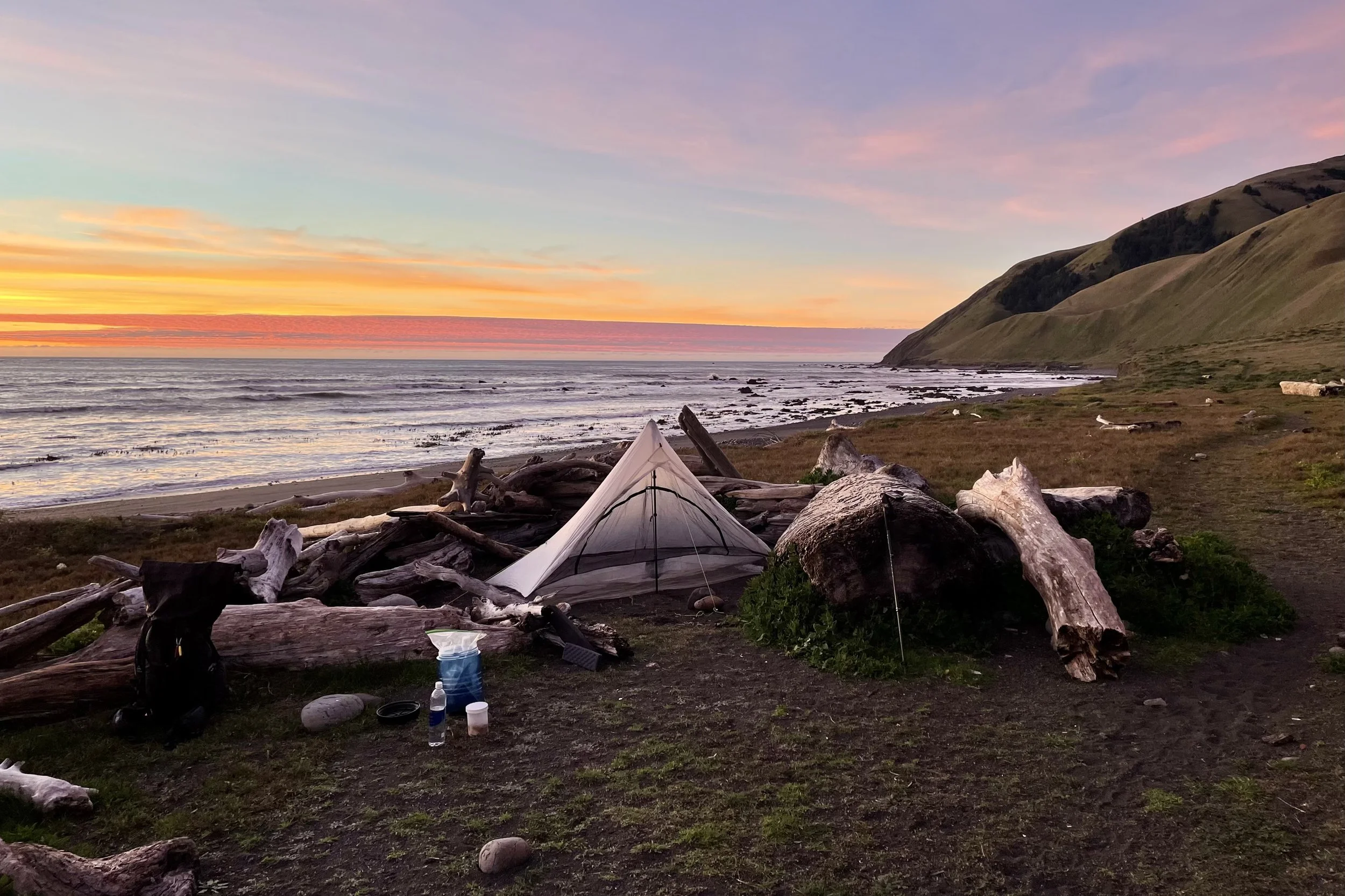 Image 3 of 5
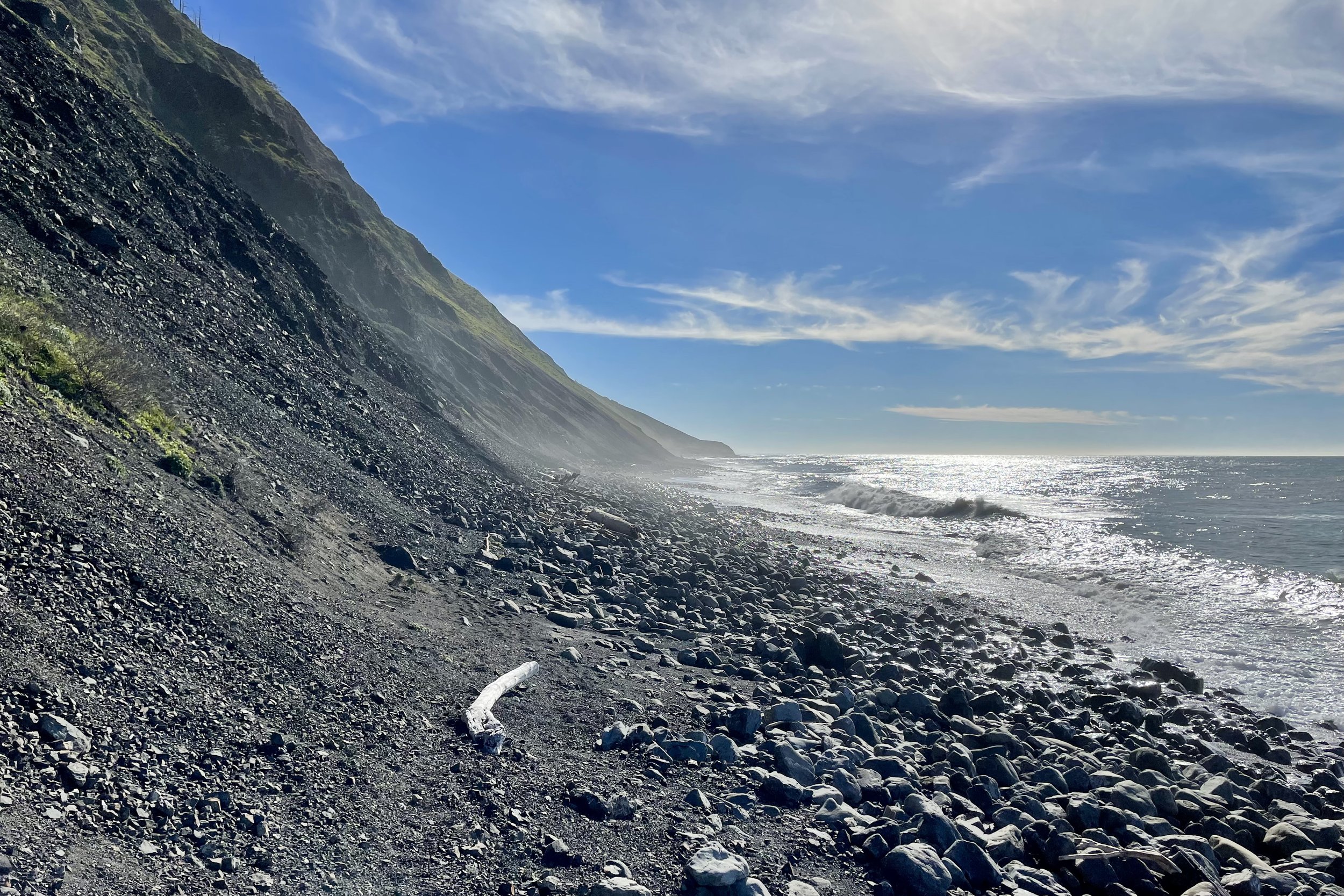 Image 4 of 5
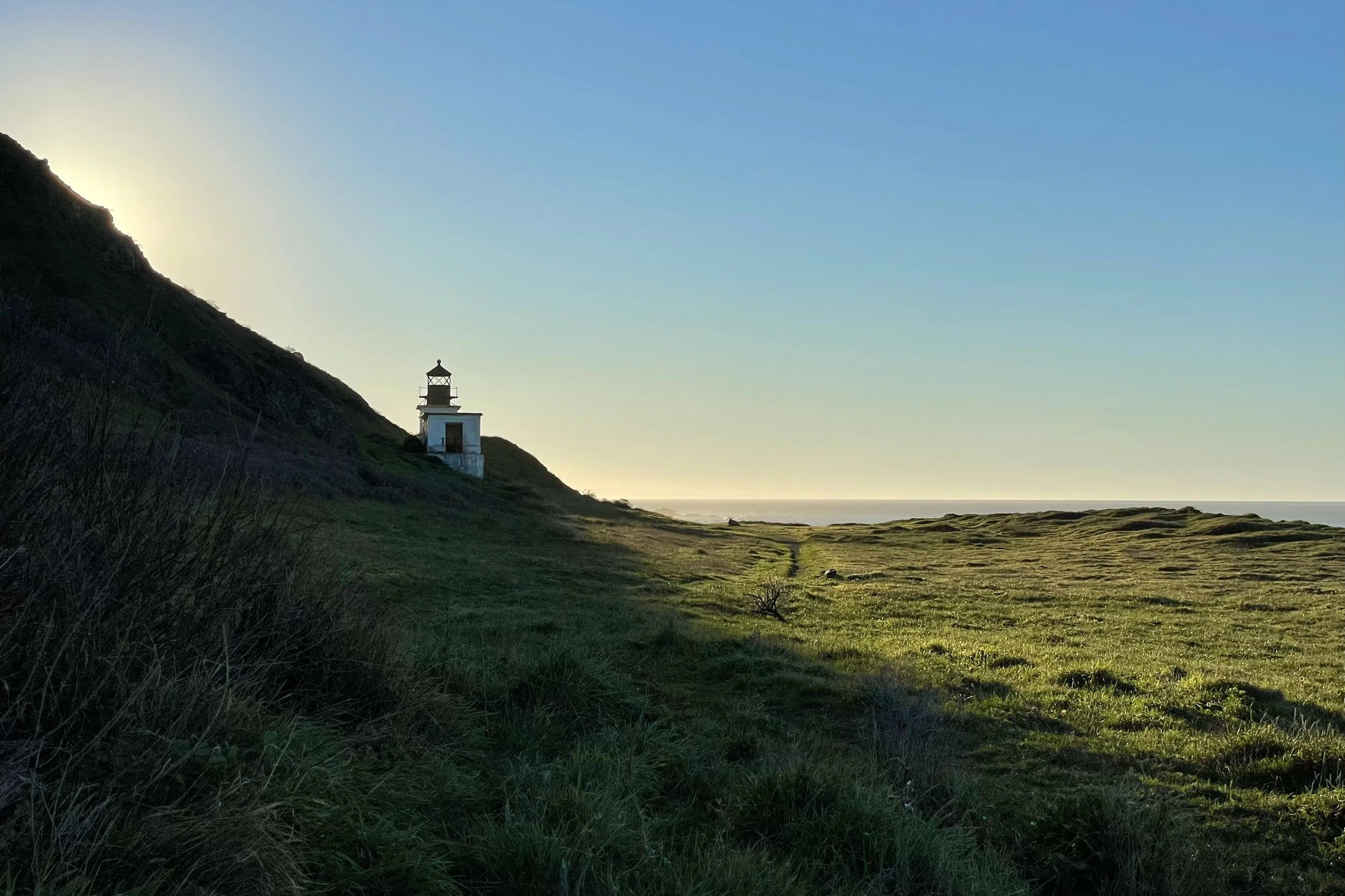 Image 5 of 5
Is this trip right for you?
This is a Level 2 Explorations trip with a 3+ / 5 difficulty rating. It is more committing than Point Reyes: longer days, rougher footing, full exposure to coastal weather, and travel that is shaped by the tides. There is relatively little elevation gain, but that does not make it easy. Walking for hours on sand, cobble, and loose rock with a pack is real work.
You don’t need prior backpacking experience, but you should be a strong day hiker who is comfortable on uneven ground, sleeping outside, and interested in learning how to travel safely in a dynamic coastal environment.
If you are unsure which trip or level is best, read more about our Trip Levels & Difficulty or contact me and we’ll figure it out together.
You’re a good fit if you:
Can comfortably hike 8 to 10 miles in a day on uneven surfaces
Are okay walking for hours on sand, cobble, and loose rock with a pack
Can carry a 30 pound pack at the start of the trip, lightening as we eat
Are comfortable around the ocean and not easily rattled by surf, wind, and isolation
Are excited to learn how tides and swell affect your day and to let them set your hiking rhythm
Consider a different trip for now if you:
Have ankle, knee, or balance issues that flare on unstable footing
Really dislike being sandy, salty, and slightly damp for several days in a row
Feel nervous around waves or worried about ocean hazards
Prefer shaded, forested trails and are not ready for full exposure to wind and weather
Want something more front-country, with easy exits and predictable schedules
Why your guide loves this trip
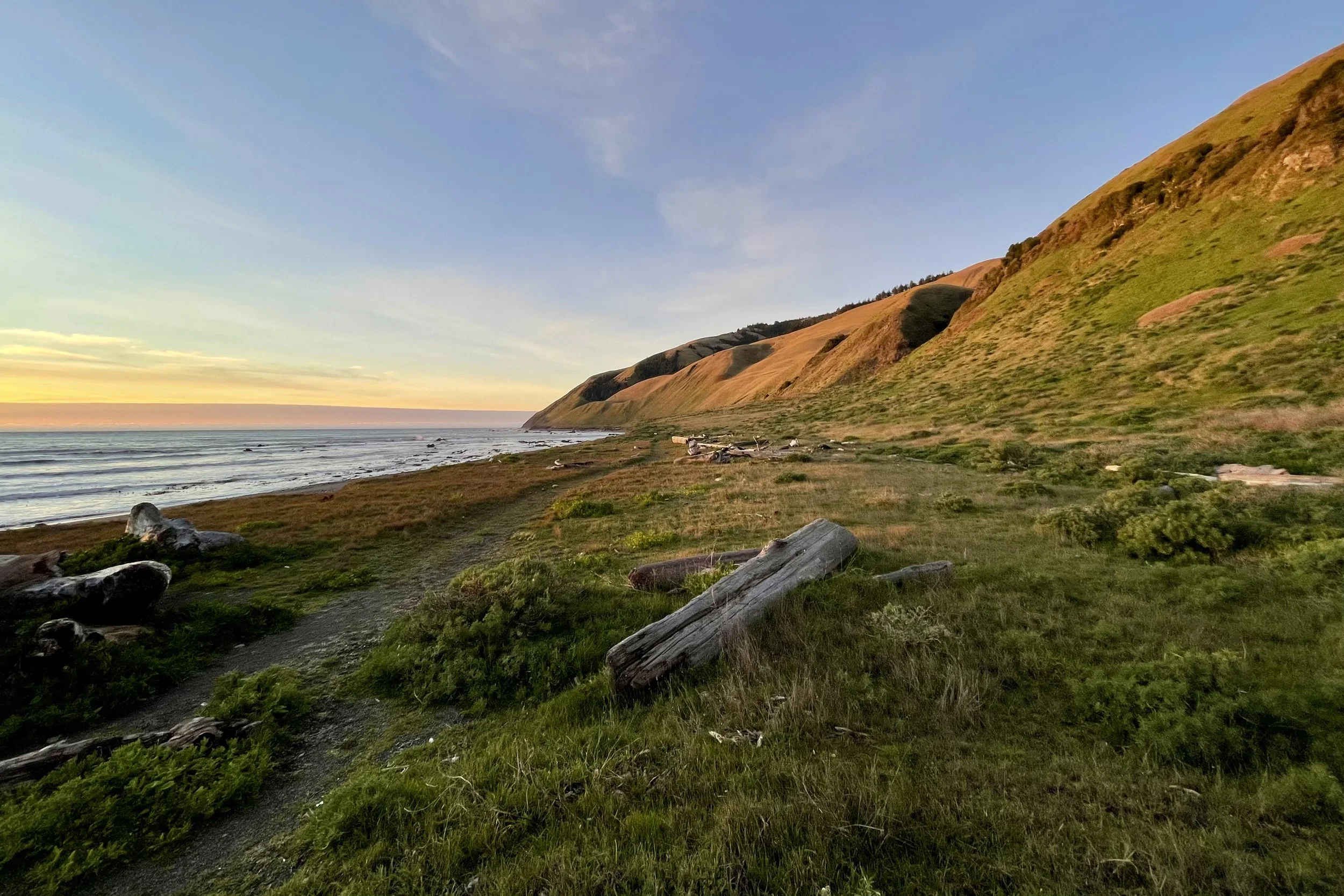
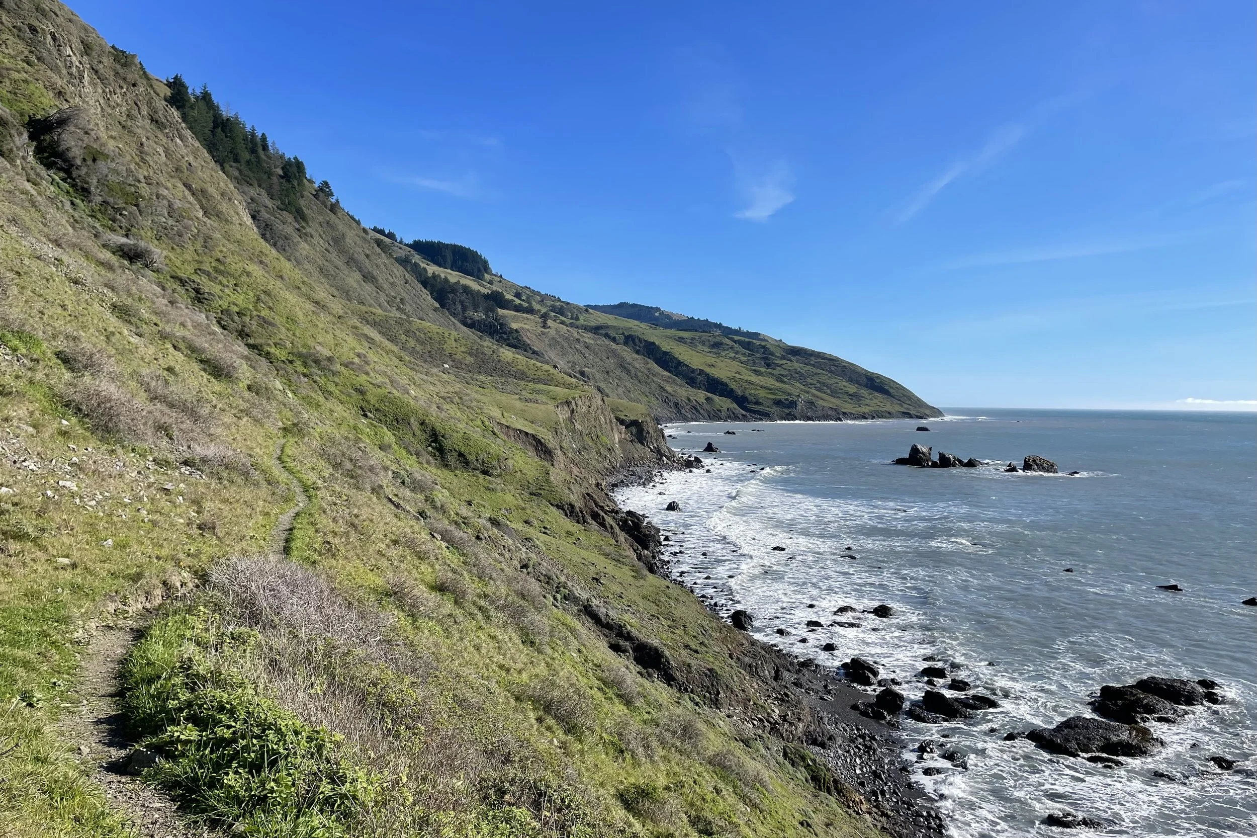
Walking the Lost Coast is like stepping back in time. Its rugged and remote beauty is what the California coast looked like before human development. Thanks to its isolation, it’s a sanctuary for elephant seals and a home to one of the most pristine examples of coastal prairie anywhere.
I love guiding here because the coast feels alive and dynamic. The ocean sets the schedule. We move when the tide says go, we rest when it says stop, and life gets pleasantly simple.
On this trip we move through:
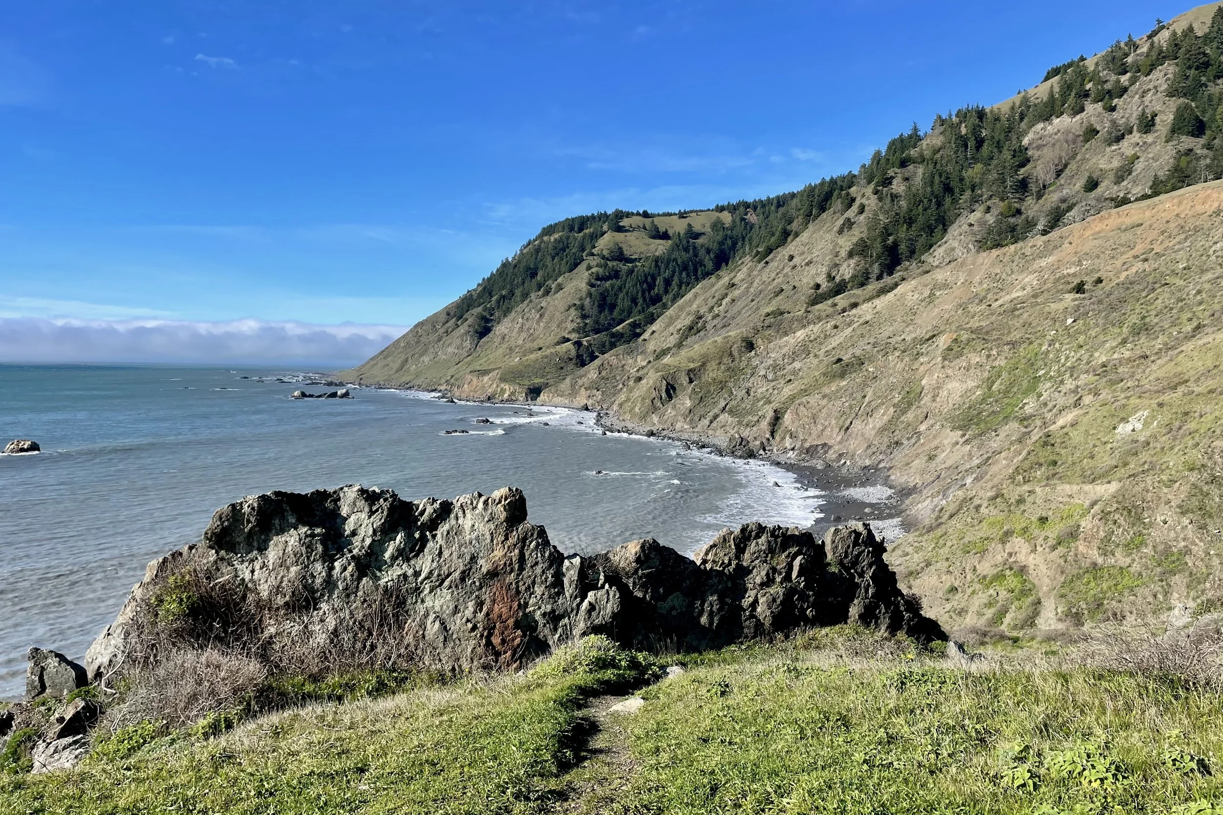
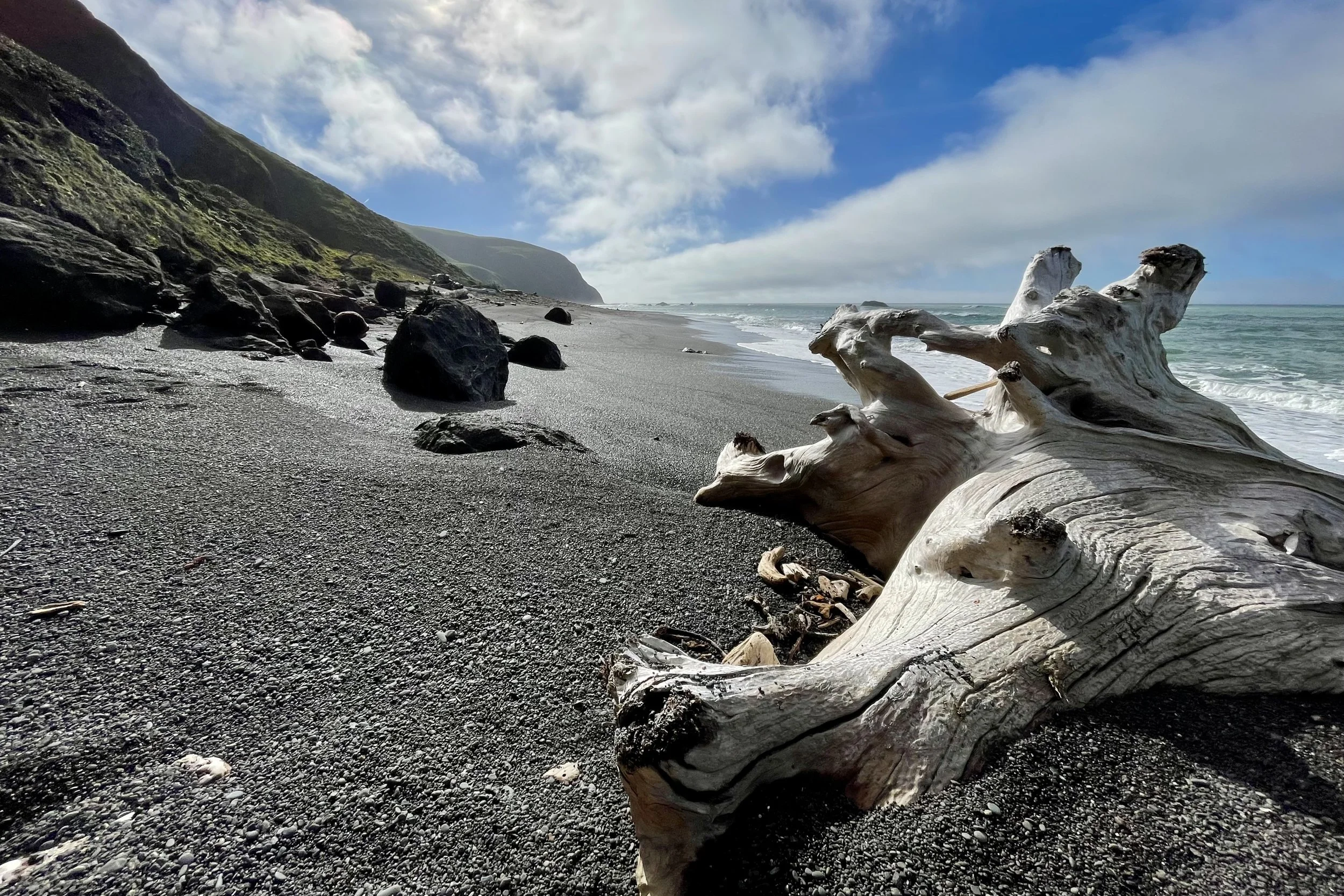
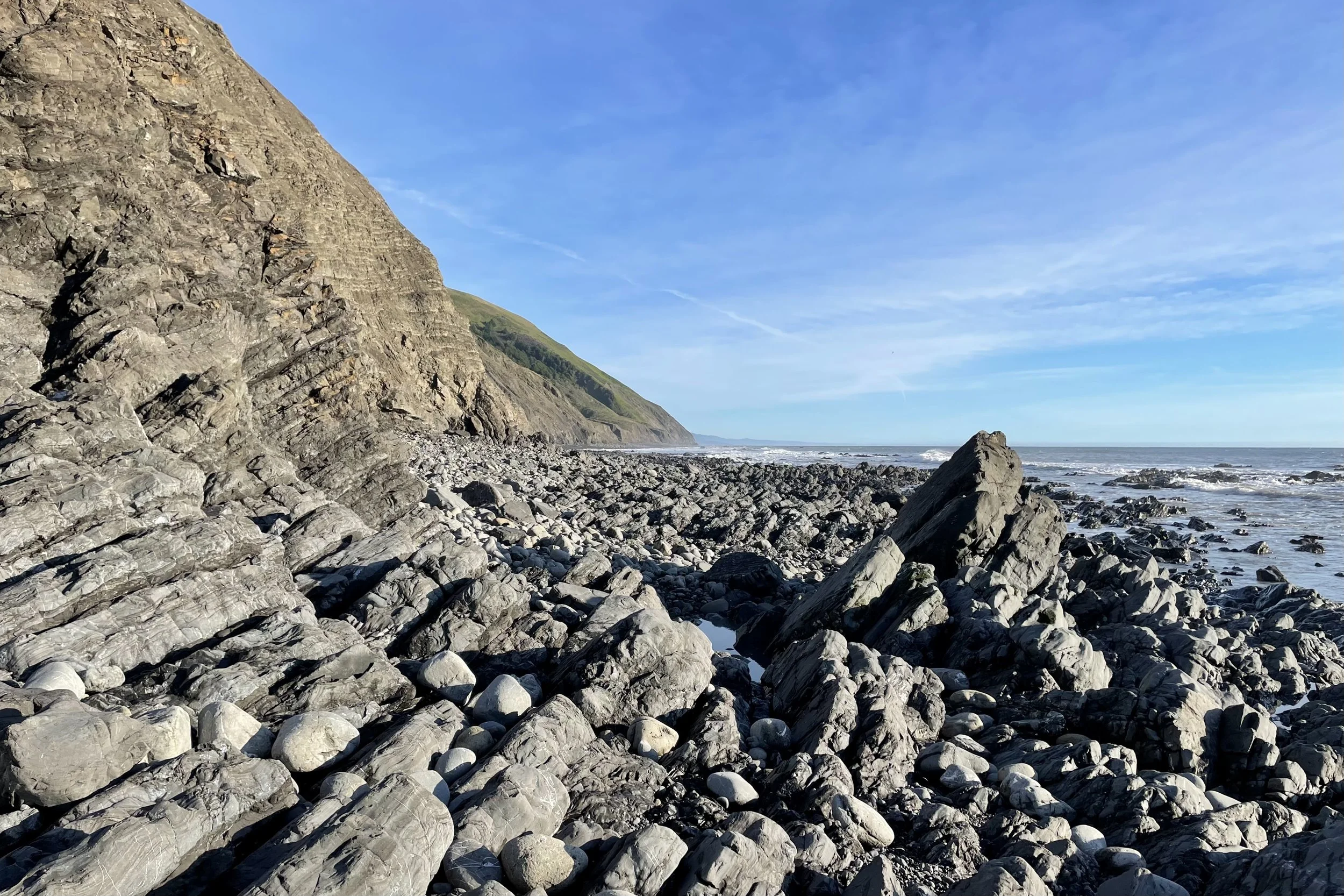
Long stretches of black sand and coarse gravel beaches with surf in constant motion
Tidal pinch points where cliffs drop straight into the ocean and timing matters
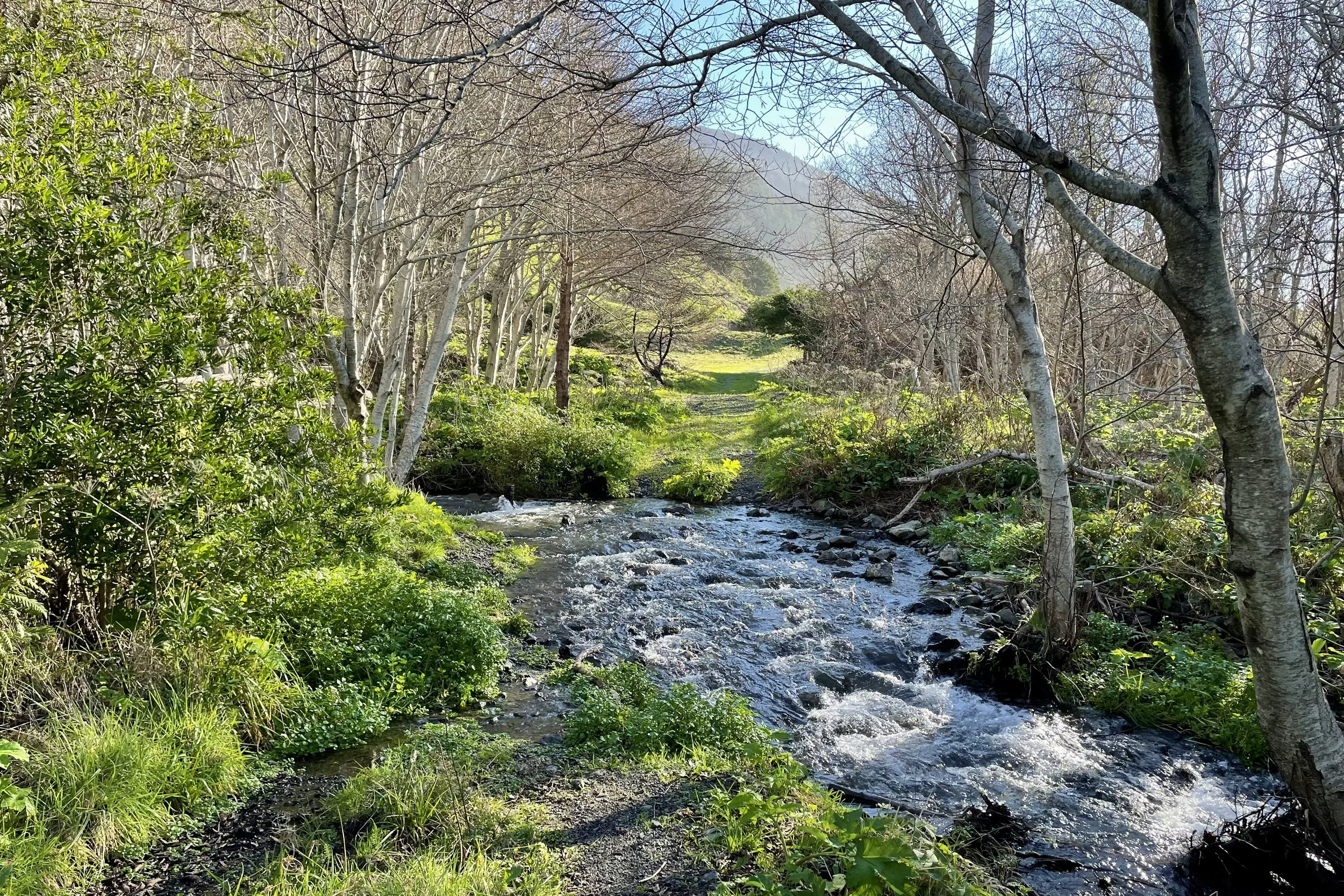
Creek mouths braided through sand, driftwood, and seaweed
Short use-trail sections that hop over bluffs or cut inland around obstacles
An abandoned lighthouse that looks over a vibrant elephant seal rookery
Across four days you can expect:
Camps on remote beaches with nothing but surf, wind, and seabirds for company
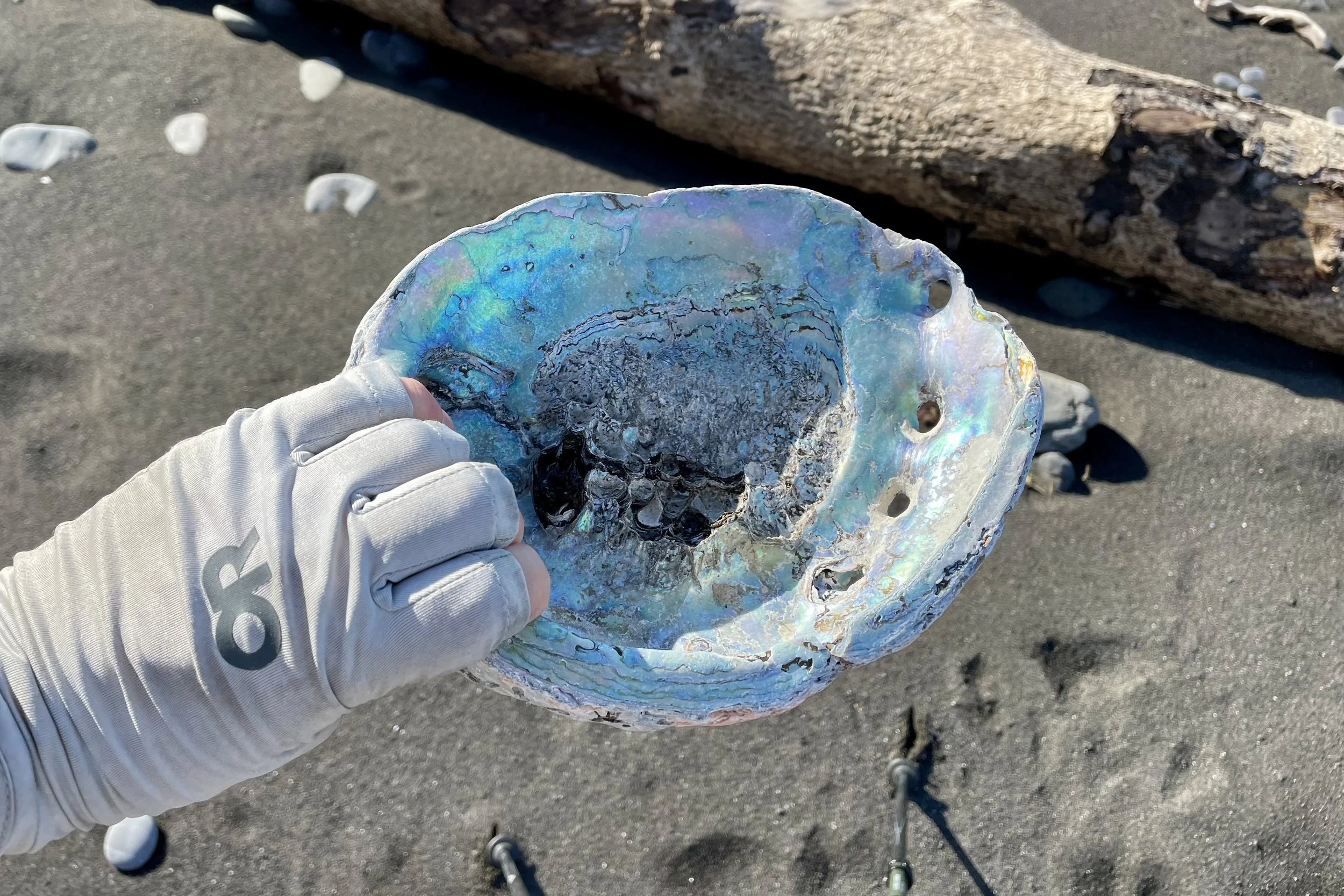
Tide lines, driftwood, seaweed, maybe black bears and elephant seals sharing the beach
Evenings watching the light fade over the Pacific and stars emerge over the surf
The kind of quiet and remoteness that is increasingly rare on the California coast
A simple rhythm of eat, walk, watch the ocean, sleep, repeat
The aim is not to “conquer” a notorious coastal trail. It’s to learn how to move with the coast instead of fighting it, and to feel at home in a landscape that many people find intimidating.
What you’ll learn on this trip
On this Level 2 coastal trip we strip systems down to what actually works in sand, salt, and variable weather, and focus on simple, resilient systems and coastal judgment while keeping the experience grounded and accessible.
All Wilder Walks trips are hands-on and participatory. Learn more about what to expect before and during your trip.
This trip will be guided by me, Alex, the owner of Wilder Walks. Learn more about me and my guiding style.
Over four days, we’ll:
Fine tune a minimalist, coastal-ready kit so you are prepared for damp, sandy, and occasionally windy conditions.
Learn to read tide tables and swell forecasts at a basic level and use them to plan each hiking day.
Practice moving efficiently on sand, cobble, and boulders in a way that protects your joints and manages fatigue.
Dial in foot care and blister prevention that works when your feet spend time wet or sandy.
Talk about coastal fog, wind, and weather patterns and what they mean for start times, clothing, and safety decisions.
Work on pacing and energy management when the ocean, not the clock, sets your schedule.
Deepen your understanding of coastal ecosystems: how river mouths, offshore rocks, and drift lines show you where energy and life concentrate along this edge of the continent.
You don’t need to show up knowing any of this but some familiarity will help us go deeper. We will start from wherever you are, talk through everything in plain language, practice together, and repeat key skills so they stick.
Trip Itinerary
We designed this itinerary to balance tide-timed travel, solid daily mileage, and time to actually live on the coast. Exact start and end trailheads, camps, and the direction of travel (north to south or south to north) may shift based on tides, permits, and conditions. If we adjust, we will match or improve on the experience and keep the trip within the Level 2 Explorations and 3+ / 5 difficulty range.
-
We meet in a nearby coastal town, do introductions, review the tide plan, and shuttle to our starting trailhead.
Once at the coast, we shoulder packs and begin hiking along the beach. The first day is about finding your feet on sand and cobble, learning to read tide lines, and settling into the rhythm of the ocean.
Camp is on a broad section of beach above the high tide line, near a creek that provides fresh water.Hiking distance: 4 to 6 miles
Elevation gain / loss: minimal, with a few short ramps on and off the beach
Meals included: Lunch, Dinner
-
Today is a tide-driven travel day. We wake in time to catch a safe low tide window for a known tidal pinch point, where the beach can be cut off at higher tides.
We’ll spend time discussing tide timing and making choices about whether to move or wait. Expect a mix of black sand, coarse gravel, cobble, and small boulder fields.
In the afternoon, once we are through the more serious tide sections, we make camp at another remote beach with a nearby creek.
Hiking distance: 7 to 9 miles
Elevation gain / loss: modest ups and downs on beach and short use-trail sections
Meals included: Breakfast, Lunch, Dinner
-
By Day 3 we’re well away from our daily lives. Depending on our start point and direction, we may have one more pinch point to time, or we might be past the tightest features.
This day usually includes longer continuous stretches of walking with time to look for wildlife, explore drift lines, and notice how the coastline changes with orientation and swell.
Camp is again on the beach or a small bluff, often with wide evening light and long views down the coast.Hiking distance: 7 to 9 miles
Elevation gain / loss: similar to the previous day, with short ramps and low bluffs rather than big climbs
Meals included: Breakfast, Lunch, Dinner
-
Our last morning tends to feel streamlined. We pack up, time one final tide window if needed, and hike the remaining miles to our pickup point.
At the end of the trail we reconnect with our shuttle (or our parked cars), and debrief the trip: what you saw, what you felt, and what you learned about moving with the ocean.
Hiking distance: 4 to 6 miles
Elevation gain / loss: modest, usually a mix of beach and short trail sections
Meals included:
Breakfast, Lunch
What’s included
Comprehensive backpacking instruction: virtual pre-trip preparation, on-trail coaching on essential backpacking skills, and interpretation of local natural history
State of the art ultralight backpacking gear including shelter, sleep system, pack, and cooking system for those who need it, with total base weight under 10 pounds (not including food and clothing)
Lightweight, nutritious breakfasts, lunches, and dinners from Dinner on Day 1 through Lunch on Day 4, plus hot coffee and tea each morning
All group gear including a fully stocked camp kitchen, water filters, and group first aid kit
All necessary permits and campsite fees
Shuttle to/from our cars, depending on final direction of travel
5% donation to Big City Mountaineers, helping fund backpacking trips for California youth
A small, supportive group and a guide focused on your learning and experience
What’s not included
Clothing, footwear, and other personal items
Personal snacks for the trail
Transportation to and from the meeting place
Lodging before or after the trip
Trip insurance (highly recommended)
You will receive detailed guidance on clothing, footwear, and snacks during pre trip preparation.
Trip difficulty & fitness
The difficulty of this trip is rated: 3+ / 5
There’s not a lot of big climbing on this route, but the terrain is demanding. Sand, cobble, and loose rock underfoot make the miles feel longer and require steady attention. Tidal pinch points and full exposure to wind, fog, and sun add a layer of commitment.
You can learn more about how we rate trip difficulty. If you’re unsure about whether this trip is right for you, contact Alex and we’ll figure it out together.
At a glance
Duration: 4 days, 3 nights
Average daily distance: roughly 6 to 7 miles
Maximum daily distance: potentially up to 8 miles
Average daily elevation gain: minimal
Terrain: black sand, gravel, cobble, boulders, tide-washed sections, and short sections of use trail
Creek crossings: we’ll cross several creeks that may wet you up to your thighs, depending on conditions
Tides: several sections that must be traveled near low tide; days are planned around safe tide windows with buffer time
Exposure to heights: low, with occasional short bluffs above the beach
Weather exposure: full coastal exposure with possible wind, fog, sun, and blowing sand
Trip logistics
Meeting place
We meet in a small coastal town near the Lost Coast trailheads, commonly Shelter Cove or the Petrolia area, depending on the specific itinerary. The exact meeting point and shuttle plan will be provided in your pre-trip materials.
Starting & Ending time
Plan to meet at the meeting place by 8:00 AM on the first day of your trip.
We aim to return to the trailhead by early to mid afternoon on Day 4. Actual timing can vary with tides, surf, and group pace. If you have same day travel plans, build in some buffer.
Getting there
You are responsible for getting yourself to and from the meeting town. Pre-trip materials will include driving directions, lodging suggestions, and an overview of shuttle options.
What to expect after you book
After you reserve your spot and submit your deposit:
You’ll receive a booking confirmation and receipt by email.
You’ll get a link to a short online questionnaire about your hiking experience, fitness, injuries, and any goals or concerns.
I’ll review your answers to make sure the trip level is a good match for you and the group. If anything looks off, I’ll get in touch to talk through options.
Once everything looks good, I’ll confirm your spot and send a detailed trip packet with a packing list, training suggestions, and logistics overview, plus info about pre-trip calls.
“Alex’s thorough pre-trip preparation was top-notch. I felt confident in our gear, route, and options to adjust for weather as we went along”